Teaching Segregation in Connecticut
This chapter was prepared for the “Separate by Design: Teaching the History of Residential Segregation in Connecticut” educator workshop, sponsored by the Gilder Lehrman Center at Yale University, with Anthony Roy, Tom Thurston, Rashanda McCollum, and me on May 13th, 2021.
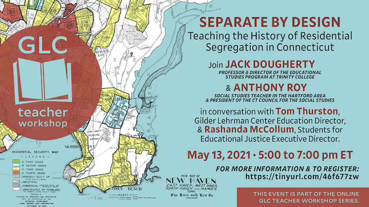
Figure 8.22: Learn more about this event from the Gilder Lehrman Center at Yale, and view the video recording.
While researching and writing this On The Line book-in-progress with undergraduate students at Trinity College, our primary goal has been to make visible the hidden boundary lines that have divided metropolitan Hartford from the past to the present, in order to engage wider audiences with our troubled history and pathways to changing our future. Rather than waiting until the full manuscript is finished, my contributors and I created this open-access book and uploaded chapters as we completed them to make this history more findable and useful. Also, we strived to write introductory-level chapters—since that’s where all of us begin—and to offer clear explanations instead of complex jargon. Pictures also play an important role in the book, and we’ve added interactive maps, charts, and other illustrations to help communicate concepts that can be difficult to grasp with words alone.
The racial and economic segregation we see today did not happen overnight, nor was it caused by nature. The segregated patterns today were created by decisions made by prior generations of elected leaders, real estate interests, and homebuyers. Making sense of how cities and suburbs evolved over time is not simple. But if we really want to dismantle systemic racism and related power structures that shape our present-day reality, then we need to understand how these systems actually work.
Teaching historical thinking is one part of the solution. In my prior work as a secondary school teacher, I learned the power of posing thoughtful questions—and providing accessible primary sources—to guide students to think like historians. Sam Wineburg and colleagues have created several valuable resources to assist K-12 teachers in this process, which build on the field of inquiry-based learning.259 In our state, Rebecca Furer has led the development of the TeachItConnecticut at CT Humanities, a growing collection of inquiry-based lesson plans to help elementary and secondary educators guide students to “think like historians” with Connecticut primary sources. To be clear, more work remains to be done. In particular, we need to fulfill the promise of CT Public Act 19-12 to include Black and Latino Studies in the public school curriculum. We also need to continually rethink the mainstream curriculum, and ways to connect White students and communities with the Connecticut’s history of segregation, and how to speaks to all of us.
In this spirit, this chapter suggests ways to pair historical questions and source materials from the On The Line book that educators are welcome to freely borrow and adapt for their classrooms. While my current teaching context is at the college level, I’ve always been impressed by K-12 educators who find creative ways to integrate complex topics into the K-12 curriculum. If you have inquiry-based Connecticut history lesson plans you wish to share with other educators, consider sharing it with TeachItCT, or if you teaching ideas that are directly relevant to On The Line, please contact the authors.
Neighborhood Change
Question: How have neighborhoods changed in Connecticut from 1934 to today?
Source: Map of Neighborhood Change in Connecticut, 1934-present.
Figure 8.23: Explore the full-screen interactive map of neighborhood change in Connecticut, which displays side-by-side aerial imagery from 1934 to the present for the entire state. Search for an address and zoom into a specific location. Click the “Permalink” button in the bottom-left corner to save a specific view to share with others. For example, view how 1960s interstate highways carved up cities such as the I-84 exchange in Hartford’s Parkville neighborhood, or how suburban commercial and residential development altered rural farmland such as the WestFarms Mall area in West Hartford/Farmington. Open-source map developed by Ilya Ilyankou and Jack Dougherty for On The Line at Trinity College, with MAGIC UConn Libraries.
Activity:
- Enter your school address. What looks different between then and now? What looks similar?
- Enter your home address. What looks different between then and now? What looks similar?
- Follow the path from your home to school. What differences or similarities do you notice?
- What might have caused the changes you see in the photos?
- What kinds of things can you not see in the aerial photos?
Thanks to teacher Josh Blanchfield for sharing his ideas and experiences on using the neighborhood change map with his students.
Read more: Connecticut State Library, “Aerial Photographs of Connecticut [1934-present], http://libguides.ctstatelibrary.org/hg/aerialphotos/home.
Teacher Tip: Most On The Line maps can be display with or without the explanatory caption by truncating the last portion of the web link. This allows educators to choose which format works best for their students.
- With caption: https://ontheline.github.io/otl-neighborhood-change/index-caption.html
- Without caption: https://ontheline.github.io/otl-neighborhood-change/
Redlining Neighborhoods
Question: During the 1930s Depression, federal government officials and local bankers created maps and documents showing neighborhoods where they recommended giving loans to home owners. Years later, we call these “redlining” maps. What factors influenced their neighborhood ratings?
Sources: Map of Federal Home Owner’s Loan Corporation (HOLC) “Redlining” in Hartford Area, CT, 1937.
Figure 8.24: Click on color-coded areas in the full-screen interactive map to view one-page HOLC appraisals for each neighborhood in 1937, and the factors that field agents and local banks and lenders considered. They rated not only the physical condition of property, but also the “social status of the population,” and downgraded neighborhoods with Black, immigrant, and lower-income residents. Decades later, activists labeled these discriminatory lending practices as “redlining.” View open-source code and historical data, developed by Ilya Ilyankou and Jack Dougherty, with UConn MAGIC and the Kirwin Institute.
For HOLC maps elsewhere in CT and the US, see Robert K. Nelson et al., Mapping Inequality: Redlining in New Deal America, American Panorama, Digital Scholarship Lab, University of Richmond, 2018. See also the “Downloads” page for specific areas.
Figure 8.25: Zoom in and click on HOLC maps and appraisals for cities across the US in the full-screen interactive version of Mapping Inequality: Redlining in New Deal America by Robert K. Nelson, LaDale Winling, Richard Marciano, Nathan Connolly, et. al. Their collection includes HOLC materials for several regions in Connecticut: the Hartford area, New Britain, New Haven, Stamford, Waterbury, Darien, and New Canaan. According to the National Archives, HOLC materials also exist for Bridgeport and New London, Connecticut, but have not yet been digitized.
Activity: Explore the interactive map and documents, or download them for your area. Assign student teams to focus on different neighborhoods and pool their findings. How did the mapmakers rate and describe different neighborhoods? What factors influenced their recommendations about who should receive home loans?
Warning: The 1930s redlining maps and documents contain harmful words that reflect the racial, ethnic, and economic prejudices of the people who created them. Don’t allow your lesson to reinforce stereotypes. Teach students to recognize and disrupt inequalities.
Read more:
Shaun McGann and Jack Dougherty, “Federal Lending and Redlining,” On The Line book-in-progress, https://ontheline.trincoll.edu/lending.html.
Robert K. Nelson et al., “Mapping Inequality: Redlining in New Deal America,” American Panorama, Digital Scholarship Lab, University of Richmond, 2018, https://dsl.richmond.edu/panorama/redlining/. See “Introduction” for historical background.
See more interactive maps
Explore all of the On The Line interactive maps we’ve created so far—and watch for new ones to come—at the top of the Mapping and Publishing chapter in this book.
Who Lived Here?
Questions: Who lived in a specific house or street long ago? Which residents stayed, and which ones moved? How do different streets or neighborhoods compare on stability or turnover? What factors might have influenced people’s decisions? What do these patterns tell us about neighborhood change?
Activity: Access the subscription-only Ancestry database, “US City Directories, 1822-1995,” https://www.ancestry.com/search/collections/2469/, and download pages for specific streets if needed. Many CT public libraries provide access to Ancestry.com when using the library network. Some public libraries also provide access to the HeritageQuest database when using your library card, https://www.heritagequestonline.com/.
Where Can You Afford to Live?
Teaching the history of segregation can be challenging if learners do not have personal experience with searching for an apartment or house to rent or buy. See the Home School Shopping simulation in this book.
Oral History
Build stronger inter-generational communication and understanding with oral history interviews. See activities in the Teaching Oral History section of this book.
Recent News on Residential Segregation in Connecticut
Emily DiSalvo, “Hamden Confronts Legacy Of Segregation,” New Haven Independent, April 27, 2021, http://www.newhavenindependent.org/index.php/archives/entry/hamdensegregation_/.
Eliza Fawcett, “A Fight Over Building Apartments in Mainly White Woodbridge Has Become a Flashpoint in the Debate Over Racial Equity in Connecticut. Here’s Why.,” Hartford Courant, April 30, 2021, https://www.courant.com/news/connecticut/hc-news-woodbridge-zoning-debate-20210430-x7vda5qdhfegdahtzhd64tbeiq-story.html.
Alex Putterman, “West Hartford Is Mostly White, While Bloomfield Is Largely Black; How That Came to Be Tells the Story of Racism and Segregation in American Suburbs,” Hartford Courant, February 21, 2021, https://www.courant.com/news/connecticut/hc-news-west-hartford-bloomfield-housing-segregation-discrimination-20210214-eoobsguoybguznkoa4n2ravwli-story.html.
Jacqueline Rabe Thomas, “Separated by Design Archives,” The CT Mirror, May 22, 2019, https://ctmirror.org/category/all-news/investigations/separated-by-design/.
Sam Wineburg, Daisy Martin, and Chauncey Monte-Sano, Reading Like a Historian: Teaching Literacy in Middle and High School History Classrooms (Teachers College Press, 2011), https://www.google.com/books/edition/Reading_Like_a_Historian/hJwbAgAAQBAJ; Kathleen Thompson and Hilary Austin, Examining the Evidence: Seven Strategies for Teaching with Primary Sources (Capstone Classroom, 2014), https://www.google.com/books/edition/Examining_the_Evidence/uQ9XBAAAQBAJ.↩︎
On The Line is copyrighted by Jack Dougherty and contributors and freely distributed under a Creative Commons Attribution-NonCommercial-ShareAlike 4.0 International license. ![]()
![]()
![]()
![]()